About Us
About the catchment
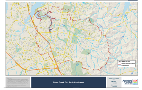
The Ōtara catchment encompasses a total area of 3,477 ha drained by 196.7km of open watercourse which discharges to the Tamaki Estuary via the Ōtara Lake. The catchment is within the two political boundaries (50/50) of the Ōtara-Papatoetoe Local Board and Howick Local Board.
The catchment was once a green and productive land, supporting clean waterways filled with fish and used for drinking, food, transport, portage and recreation.
Today the catchment is home to tens of thousands of people and the land use a diverse mix of housing, commercial, retail, industry, roads, park land, rural properties, closed landfills and sports grounds.
Streams within the upper catchment have been modified by rural farming activities and subdivision but maintain important habitat and migratory pathways for native fish including banded kokopu, connecting to upper headwaters.
The downstream reaches within the urban area are heavily modified with loss of permeable surfaces due to industry and housing development. The waterways are impacted by extreme water flow events causing erosion to the creek habitats. Where waterways have been lined with concrete, increased water temperature is also an issue and the accumulation of a range of contaminants in the water mean that within one generation the community and mana whenua have lost the ability to fish, swim, recreate and enjoy the lake and waterway system.
The primary receiving environment is the Ōtara Lake, a tidal arm of the Tamaki estuary blocked by a weir built in 1968 to retain water for use at the (now decommissioned) Otahuhu Power Station. The construction of the weir meant that the tidal function of the waterway was disrupted. Contaminants such as zinc, copper and lead are now trapped within the 50 hectare Ōtara lake, along with an estimated 230,000 m3 of sediment and a thriving mangrove infestation.